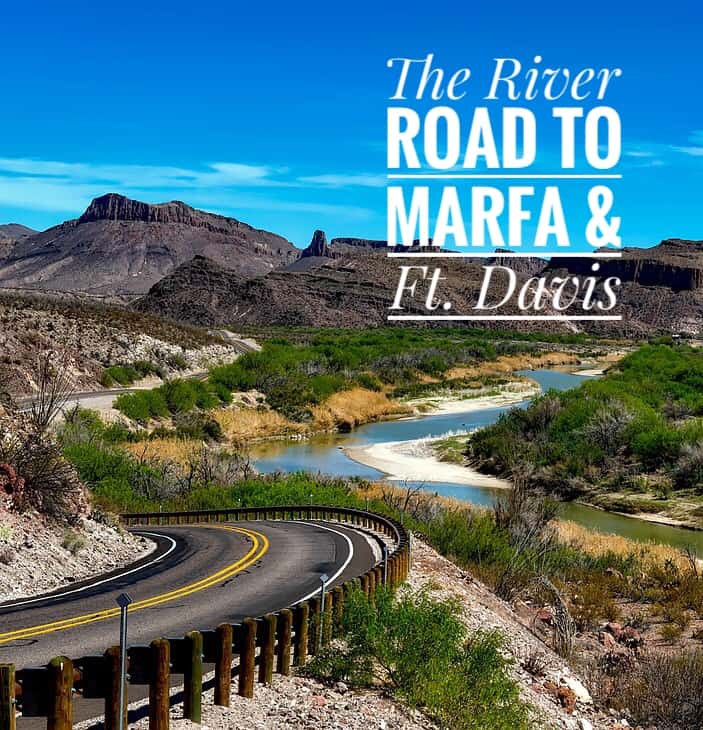
River Road – “Last True Frontier”
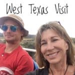
Shane was dozing and I was driving, savoring the quiet as we headed beyond the Big Bend National Park to Marfa and Fort Davis. We were on the River Road (Texas FM 170) and had just passed Terlingua headed towards Presidio. It was around 4:30p. It would be dark within the hour. This highway was not a good place to be after the sun sets.
National Geographic calls the Big Bend region of Texas one of the last true frontiers in the Lower 48, a landscape unique in the world. “One 1930’s resident likened it to the dark continent, perhaps for the African-style terrain and abundant wildlife.” FM-170 stretches 67-miles between Presidio and Terlingua and lives up to the borderland designation. The road snakes and dips and climbs, every so often showing you the Rio Grande River on your left. Vast open areas follow place where the road threads through narrow rock cut-thrus.
A narrow escape
Headed north, there is an early stretch of loop the loop hills before you get to the more radical curves. As empty as the River Road is, we ended up following a dually pick-up truck dwarfed by an impossibly large gooseneck camper. Think of an ant dragging a beetle. Even with that load, the truck was booking it. Suddenly, the spare tire bolted to the undercarriage of the trailer broke loose.
We were climbing a steep hill when the tire starting bouncing wildly towards us. I’d left enough room to react but I didn’t know if someone was coming up the back of the hill in the opposite direction. If we stayed in our lane, the tire would hit us, probably coming through the windshield. I served completely across the center line to let the tire bounce by, then pulled back into our lane as we crested the hill. Shane was jerked awake and I was shaking. In a random moment, our west Texas adventure could have ended very badly. Instead our narrow escape now made us feel each experience more vividly.
Not appealing to the jet set
The River Road ride returned to semblance of normal. Very occasionally, something totally out of place popped up like the Lajitas resort, a failed attempt by an Austin developer to make a high end enclave for the jet set.
Lajitas shared the same boom and bust history with Terlingua. The closing of the quicksilver mines dropped the population of Lajitas to four people. In 1977, a Houston developer started putting in a golf course, some condos, and other lodging. In 2000, another developer aimed even higher, putting in a high end resort that was out of money by 2007. Even a beer-drinking goat, Col. Clay Henry who was also mayor of Lajitas failed to rope in the swells.
In a more practical move, another group of investors bought Lajitas, cut prices in half and found some success in providing more affordable accommodations to less affluent visitors to Big Bend.

Anticipating The Big Hill
Our main reason for taking the more treacherous and beautiful River Road was to drive over the Big Hill. Coming from either direction on TX-170, you see deceptively non-threatening signs warning of the Big Hill. Don’t be fooled. It is a very big and hidden hill overlooking the Santana Basin, Mexico and the Rio Grande extending to the north. How remarkable that Texas, a state addicted to hyperbole doesn’t call the Big Hill something more impressive. Or it could be Texans are just messing with out-of-state visitors.
We pulled over to pause and enjoy the view but were distracted by two young lovers who sat entangled on a rock in this lonely place. We tried to ignore them and look beyond to the river far below. They looked at us to emphasize that we had intruded on a private moment. The magic was gone for both of us… but it is still a really big hill.
Made it to Marfa
Coming into Presidio as the it became full dark, we were ready to get to Marfa. It had been another long day, and we were starting to get the traveler’s sense that is time to head towards home. When we finally got to Marfa, checked into the Hotel Paisano and went downstairs for a late dinner, Shane said, “I love you, Mom but I’m ready to be around someone else.” “I completely agree with you,” I told him. We toasted his conquest of Big Bend’s Emory Peak earlier in the day. With the long drive and the near accident, it seemed in the distant past.
The Hotel Paisano
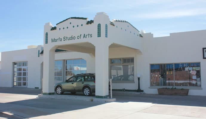
Marfa on paper turned out to be more interesting that Marfa in person, at least in our eyes. To be fair, it was a Monday morning. Marfa had become an art/tourist destination and a major center for Minimalist art. Many shops and restaurants were closed on Mondays after the weekend rush.
The Hotel Paisano, on the other hand, was all that we expected. Started in October 1929 just days before the collapse of Wall Street and the beginning of the Great Depression, it was designed by El Paso’s Henry C. Trost. Trost was architect for university and office buildings, mansions and hotels from Marathon, Texas to Tucson, Arizona. We’d stumbled upon his work many times on this trip and overnighted in the Holland Hotel he had mapped out in Alpine.

James Dean slept here
In June of 1955, the Paisano was Warner Bros. headquarters for the filming of the classic movie, Giant. The lobby walls were filled with framed photographs of young Rock Hudson , Liz Taylor and James Dean wearing 50’s era jeans and cowboy hats. I loved the candid glimpses of the stars goofing around on the desert set between takes and talking with the locals.
A souvenir of Marfa
 If you enter the hotel from Texas Street, you walk through a peaceful patio with flowing fountain on your way to the lobby. The hotel’s address, however, is on Highland Street. Entering on that street, you’ll have to maneuver through quite a few galleries and gift shops before get to the desk clerk. Not only were we on a budget, we were also very limited on how much we could bring back on the train. Any impulse purchase had to be small enough to tuck in a backpack or a purse. I exchanged a quarter and four pennies for a green plastic swizzle stick shaped like a rattlesnake . I love to stir cream into my morning coffee with whimsical swizzle sticks so this was a souvenir of Marfa that would get a lot of use.
A quiet time in Marfa
On Monday morning, we left our car at the Hotel Paisano and walked ten blocks to the visitor’s center. A friendly young woman at the front desk confirmed that most of the town shuts down on Monday. On a side street, we found an open artist’s studio in a decommissioned church. Two dogs snoozing in the sunlight of an arched window reinforced that it was time to move on.
We’d been on the go each day and hadn’t eaten a real lunch since three days before at Reata in Alpine. We hoped to find an equally quaint place in Marfa, but that possibility was dimming. So we headed on to Fort Davis to eat, explore and kill time before we returned to Alpine to catch our train at 8:30 that night.
Moving on to Fort Davis
Forty minutes later in Fort Davis, things were not as quiet as in Marfa but nothing looked appealing. Deciding that we’d make the best of things and have a picnic, we stopped at the local grocery store to pick up lunch meat, bread, cheese, and tortilla chips. We still had a couple of glasses of wine left in our bottle from Alpine.
Leaving the store, we saw signs for a scenic loop and headed that way. The Davis Mountains State Park came up quickly and we opted to eat there. I love little Casita travel trailers which are made right here in Texas. We saw three Casitas lined up to get into the park. That was a good omen. After the ranger checked in the Casita crew, she turned to help us.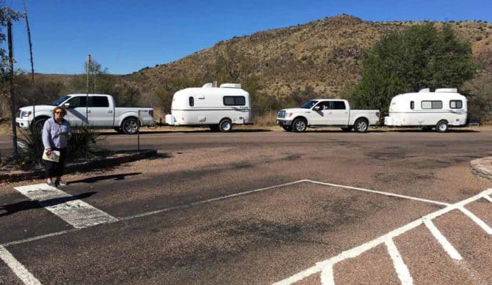
“We’ve been wondering around the area and today is our last day. What’s do you think is the most interesting place around here to have a picnic lunch?” I asked.
Asking museum docents, rangers or hotel staff about what they think is the most interesting place to visit in their area always turns up something memorable.
Finding the perfect picnic spot
She pulled out a map and a highlighter. “Go out and take the first left and keep going. That will take you up the Skyline Drive.” She pointed up the hill visible from the entrance office. ” There are two overlooks at the top. From one you can see the Indian Lodge. Backtrack to a sharp left turn and drive to the other lookout where there is a small stone cistern,” she said, marking the route. “The cistern and the hut was built by the CCC and from there, you can see all of town and down to the old Fort Davis parade grounds.”
Where the CCC boys ate
She wasn’t finished. “You’ll see some stone picnic tables and if you look immediately to the left, you’ll find an overgrown area. There is also a stone picnic table and fire pit there. That’s called ‘the King’s Table’. It’s where the CCC boys used to grill and eat when they were camping up there to build the overlooks.”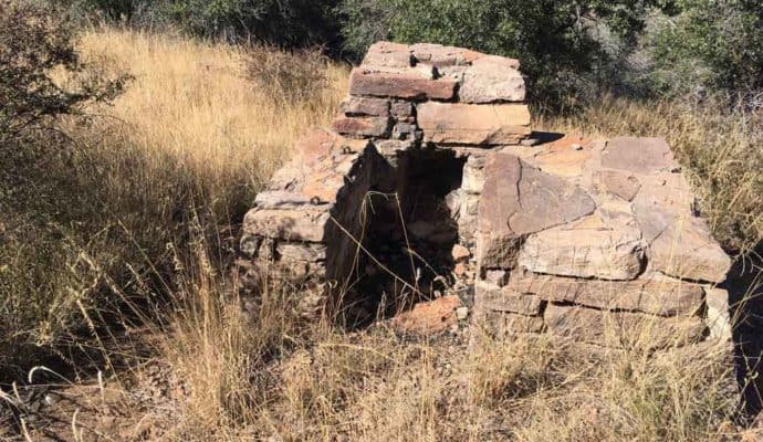
We followed her directions, past a trio of deer munching in a recently vacated camp spot and on up the Skyline Drive. We found the CCC overlook and the King’s Table. Next to it was a crumbling stone oven and grill. It was shaded and partially hidden by brush and trees. We carried over our picnic provisions, ate our sandwiches and chips , and drank the last of our wine out of light-weight plastic glasses from the Paisano’s bathroom. It was a fine meal. Thank you, CCC Boys.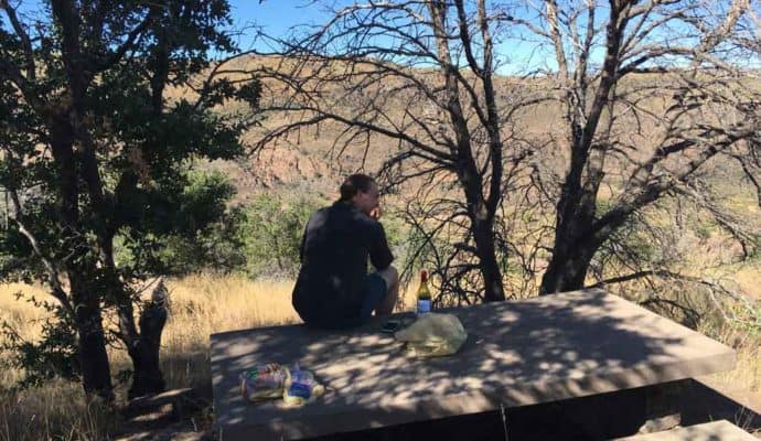
The Scenic Loop around Fort Davis
After lunch, with hours to kill and no desire to rush back to Alpine, we continued onto the scenic loop outside the Davis Mountain National Park. We were operating with only the highway signs to direct us. Had we gotten a map of the loop, we might have reconsidered.
When I did finally see a map well after our drive, it had this caution – “The Scenic loop is 75 miles of majestic scenery and wildlife. It takes two hours to complete without stopping. Be sure you have plenty of gas, water, and snacks. Please respect the privacy of others by staying on the pavement – Thank you.”
Bloys Campmeeting
The Scenic loop delivered on all the majestic scenery and the endless driving. I am glad we took it but wondered at the time if we would ever get back to people. Towards the end of the loop, we passed a forbidding and austere compound. Think Branch Davidians or a rebel polygamist sect. A metal sign read “Bloys Campmeeting”. The place looked completely deserted and yet well maintained.
Researching later to write about this segment of our trip, I learned about William B. Bloys in Texas Escapes and the Texas State Historical Association Handbook. Each source had a lengthy write-up on him. One went on to say that while Roy Bean is much more colorful and widely known, Bloys was far more influential then and now.
Bloys was a Presbyterian home missionary serving in Fort Davis. Because the ranches of the region were widely separated, it was impossible for frontier families to worship with their neighbors and friends. No matter what their denomination, Bloys rode and ministered to many of the outlying ranches along the same outback area that we’d driven.
In 1880, Bloys made a plan to bring local families together annually for religious services. An old-style camp meeting was organized and is still held annually from the first Tuesday through Sunday of August. Nothing is sold, money for lodging and food is donated with friends sharing cooking and maintenance duties. August 2016 was the 136th camp meeting.
The Shoot Big Bend film commission website promotes it as a setting for all kinds of productions. With rugged landscape and empty buildings, it could stand in for places all the world and in different centuries.
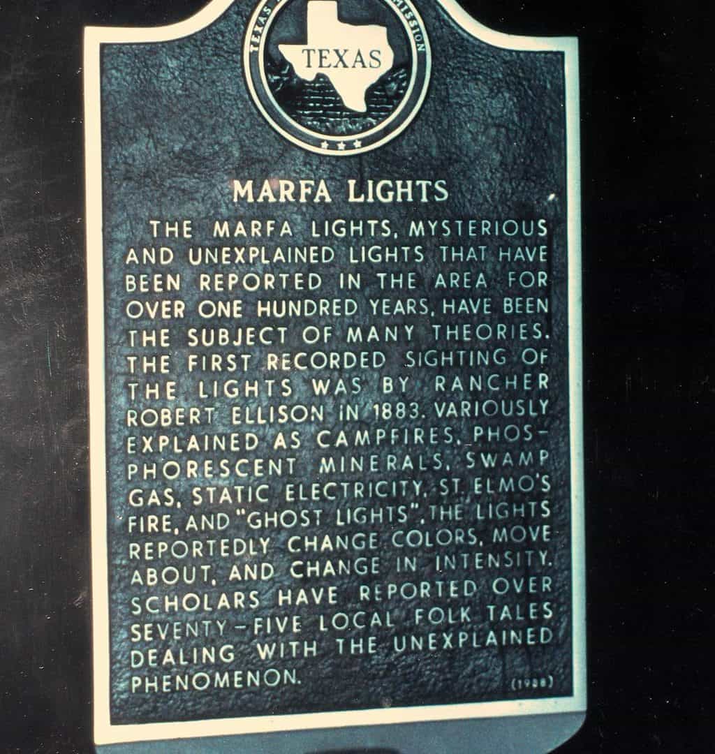
The Marfa Lights
Completing the Scenic loop at Highway 17, we retraced the drive back to Marfa and headed to Alpine. Nine miles out of town towards Alpine we passed the official viewing area for the Marfa lights. It was still early for any chance to see the bright, darting orbs that were first witnessed in 1888.
German POW’s and Marfa’s art cred
In the late 1970s, Marfa’s patron art saint, Donald Judd acquired the former fort and began converting the buildings to house permanent large-scale art installations. Building 98, on the fort, now houses World War II German POW murals, completed in 1945 by Hans Jürgen Press and Robert Humpel, who were both German prisoners of war held at the base. The idea of a military camp morphing into an artist colony was intriguing, especially with the POW connection in both incarnations.
Jumping the train in Alpine
Amtrak app said the Sunset Limited was running on time so we drove back into Alpine. Since security is pretty light when you take Amtrak, we could almost wait until we heard the train whistle entering town to lock and leave our rent car under the tree by the train station and climb aboard. Time seems different when you travel by train and we liked that, at least this first time. Tonight we would ride the Sunset Limited back to Houston. I really wouldn’t mind if we encountered some delays on our return trip. Be careful of answered prayers.