Funky Texas Traveler

Be a traveler, not a tourist. Dig deeper, learn more.

  • About
  • Attitude
    • Camping
    • How to survive and thrive when your reputation tanks – Life lessons from Mark White
    • 8 steps to unexpected success from Texas Fruitcake Queen
    • 5 Road Trip Luxuries You Shouldn’t Travel Without
    • 5 steps to grow your adventure outlook!
    • Smart Souvenir Shopping
    • Have Fun Flying – Southwest Airlines
    • Strange Places to Stay
    • Start a Party- Galveston Mardi Gras
    • We have only now!
    • Lifetime of fun at National Parks
    • Surviving Hurricane Harvey flooding – 8 practical ways to cope
    • Life’s Detours
      • Cancer
        • Breast Cancer – Think you might have it? What happens now?
        • Breast Cancer. 5 steps to take before treatment
        • My Breast Cancer Experience – A Month at MD Anderson Cancer Center
  • People
    • How to survive and thrive when your reputation tanks – Life lessons from Mark White
    • “John Cody” movie
    • 8 stupidly-simple ways the Texas Fruitcake Queen built big success
  • Places
    • Texas
      • Central Texas
        • Guadalupe River
          • Guadalupe River Luxury
          • Guadalupe River Rustic Weekend
          • Guadalupe River Tubing & Camping on River Road
        • Llano
          • Wedding haunted by Bonnie & Clyde memories
        • San Antonio
          • San Antonio Beyond the Alamo
          • Alamo City Eats
        • Schulenberg/Flatonia/Dubina
          • 8 stupidly-simple ways the Texas Fruitcake Queen built big success
      • Coastal Texas
        • Baffin Bay
          • King’s Inn – Loyola Beach, Texas
        • Boca Chica
        • Houston
          • Houston’s Best Bars and Restaurants for Sports Fans
        • Galveston
          • Galveston – Frozen in time
          • Galveston Mardi Gras
          • Big Ass Crawfish Bash
        • Port Aransas
          • Port Aransas – Best Beach Town in Texas
          • Port Aransas Farley Boat Works damaged by hurricane
          • Port Aransas post Harvey
        • South Padre Island
      • West Texas
        • Alpine
        • Big Bend National Park
          • 5 Reasons to visit Big Bend National Park
        • El Paso
        • Fort Davis
          • Frontier faith in far West Texas – Bloys Cowboy Campmeeting
        • Marfa, Texas
        • Terlingua Ghost Town
        • Wander West Texas
    • Not Texas
      • California
        • Yosemite or Yellowstone National Park
      • Louisiana
        • New Orleans
        • St. Martinville
          • Cajun Country
      • Minnesota
        • Boundary Waters BWCA
      • Mississippi
        • Meridian
      • Montana
        • Yosemite or Yellowstone National Park
      • New Mexico
        • Deming and Columbus
      • North Carolina
        • Asheville
        • Blue Ridge Parkway
      • Pennsylvania
        • Gettysburg
      • Utah
        • Yosemite or Yellowstone National Park
      • Virginia
        • Blue Ridge Parkway and Skyline Drive
      • Wyoming
        • Yosemite or Yellowstone National Park
    • Not Texas or the US
      • Belize
      • Caribbean
        • How hurricane hijacked Caribbean sailing vacation in BVI
      • Canada
        • Boundary Waters BWCA
    • Road Trip
  • Events
    • Festivals
      • Faith
        • Frontier faith in far West Texas – Bloys Cowboy Campmeeting
      • Food
      • Holiday
      • Music
    • Texas Country Music Cruise
  • Start A Blog
    • Help me understand blog talk!!!
    • How to start your blog
  • Recommendations
    • Food
      • Houston’s Best Bars and Restaurants for Sports Fans
      • King’s Inn – Loyola Beach, Texas
    • Transportation
      • Southwest Airlines Boarding Game

Oct 06 2016

You Can’t Keep A Mudbug Down


512px-Cajun_Cuisine-1-vertical-with-text-e1485543551470 You Can't Keep A Mudbug Down
Recreating the Breaux Bridge Crawfish Fest In Houston

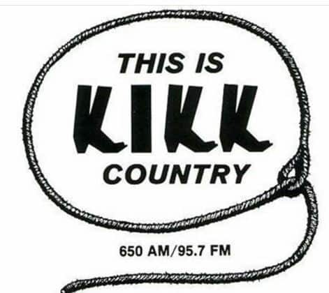
Mud bugs at Miller Theater

Surprisingly, one of the first giant crawfish events in Houston happened in the mid 1980’s in the middle of Houston’s museum district.  What began as a desire to shore up a seemingly weak line-up for the annual Miller Outdoor Theater KIKK Country Concert showed the incredible appetite that Houstonians have for mud bugs.

Texans had been traveling for years to Breaux Bridge, Louisiana,   home of the biennial Crawfish Festival.  I knew about the festival from friends who told stories of a festival so big and so much fun that the town needed two years between each one to recover.

KIKK Radio and Urban Cowboy Craze


I joined KIKK about a year after Aaron Latham had written the Esquire Magazine piece that would become the basis for the 1980 movie, Urban Cowboy.  KIKK’s twice a year concerts at Miller Theater rode the country popularity wave for over 14 years, bringing in “new” hat acts like George Strait, Alan Jackson and Clint Black and legends like Buck Owens, George Jones and Jon Conlee.

kikk You Can't Keep A Mudbug Down
KIKK Radio was Houston’s Heritage Country Station

 We needed more than music

The line-up for 1985 was not coming together.  With country music’s on-going popularity, it was getting harder to get the acts we wanted. Brenda Lee was signed as our legend, a newcomer named Jo-El Sonnier represented the emerging performer category and we had an unclassifiable act named Rockin’ Sidney, who was about to release a zydeco song called “My Toot Toot”.  Joe Ladd, KIKK’s star picker had never failed to deliver a line-up that mirrored the top of the charts by the time the show came along.  I just did not see how he could pull that off with this year’s bill.  Since Jo-el Sonnier and Rockin’ Sydney had a Cajun following, KIKK’s promo director, Joan Hayes and I headed to Louisiana  to see if we could steal some lightning from the Breaux Bridge Crawfish Fest. brenda-lee-jo-el-sonnier-rockin-sidney You Can't Keep A Mudbug Down
[Read more…]

signature You Can't Keep A Mudbug Down

Filed Under: Cajun Country, Festivals, Food, Louisiana, Music, Places · Tagged: cajun music, joel sonnier, KIKK Radio, Miller Outdoor Theater, rockin' sydney

Sep 18 2016

Canoe the Boundary Waters BWCA with a beginner paddler

I was losing sleep over this impending trip

linda-outside-of-canoe-with-textn-5-6 Canoe the Boundary Waters BWCA with a beginner paddler

I had committed to canoe the boundary waters for the first time.   I like being out in nature but no one would consider me a pioneer woman.   As the time grew closer, I had serious reservations. How was I going to do off the grid for a week of paddling through the US-Canadian Boundary Waters, officially known as The Boundary Waters Canoe Area Wilderness (BWCAW or BWCA?.  It is a 1,090,000-acre  wilderness area of north woods forests with 150 miles of  glacial lakes and streams that make up the U.S.–Canada border in the Arrowhead Region of Minnesota.  I don’t even like cold water – I have a hard time jumping into the Guadalupe River in the middle of a blazing Texas summer.  What was I thinking?

How I got “roped in”


Our son Shane had  become  an Eagle Scouts with Troop 211 in Houston.  We had developed close bonds our fellow Comanches, the adult leaders and volunteers who helped with the troop.  It was at our annual 2012 Comanche Christmas party  that a couple of glasses of wine lulled me into committing to a Boundary Waters trip over the 2013 Labor Day break.


What are the Boundary Waters?

While efforts to preserve the BWCA as a wilderness had begun in 1900, it was the historic homeland of the Ojibwa people who navigated the waters in birch bark canoes. A pictograph  on a large rock wall  overlooking North Hegman Lake has been credited to Ojibwe.  It appeared to represent Ojibwe meridian constellations visible in winter during the early evening, which would have been useful for navigating the deep woods during the winter hunting season.

800px-Bwca_map Canoe the Boundary Waters BWCA with a beginner paddler
Where the boundary waters lie

By  1730s, Europeans had opened the  region to trade, mainly in beaver pelts. and soon organized into canoe-paddling  groups working called Voyageurs.  The voyageurs became legendary in their abilities to paddle and portage and were celebrated in folk stories and music.

What we packed

On our trip, pictographs would be replaced by laminated charts and compasses. Our canoes were Kevlar instead of birch.  In case of a real emergency, we had a satellite phone.  For warmth during the cold nights, skins and furs would be replaced by nylon, gore tex and fleece.  During the warm days, sun-resistant shirts and pants and moisture- wicking underwear would keep us comfortable.

In early July, we went to REI to start buying and breaking in gear.    For me, two pairs of Columbia zip-off cargo pants, over-sized vented sunscreen shirts (2), water socks (1 pair), Merrill water shoes, Patagonia rinse- and- wear underpants and two sports bras.  A couple of pairs of wool socks and silk long johns for sleeping.  When I tried on a  cap that flattered the shape of my face, Hank over-ruled me and  had me buy a drooping wide-brimmed hat.   I wandered over to the backpack section but Hank told me the outfitters would supply that equipment.  It was still a few weeks until he elaborated on what we would use to transport clothes –  gallon ziplock bags!

Understanding Camp Routine

hanging-clothes-in-camps-600x400 Canoe the Boundary Waters BWCA with a beginner paddler
Drying paddling clothes for next day – Image by Jim Russell

Turned out that a  gallon ziplock bag of clothes proved sufficient  because we would only wear two outfits for the entire time on the water –  one outfit to paddle and portage all day and an another to change into after we stopped each night and set up camp.  Making camp meant unloading  canoes,  putting up tents, gathering firewood, paddling out into the middle of the lake to fill up our seven liters of water and treat it with tablets, bushwhacking  the path to the latrine and unloading our cooking supplies, building the fire and more.  After all the tasks were completed, we would hang  up our wet paddling clothes on lines strung between tents and put on our second outfit.  We would wear those dry clothes until time to go to bed when we would strip down to the long johns.

What about grooming?

What about shampoo, face wash, creams and ointments, deodorant?  The next shoe dropped.   We could rinse off while still in our paddling clothes but we could only use a special type of environmentally safe soap.  A quick, soapless swim was the most popular choice.   Most of the crew who had been on past trips said the key was to  shower really well the morning we left the outfitters and then expect to have greasy hair and a very ripe odor when we got back to the lodge in a week.   These guys sounded like they were really looking forward to that part.

Learning about the latrine

I asked if there was anything else I should know about.    “Have you ever used a latrine before?” someone asked me in one of our last planning meetings.  “Well, of course!” I answered.    Wasn’t latrine another name for porta-potty?  Having been on dozens trail rides and rodeos and hundreds of cookoffs, I figured I’d used roughly 40% of the porta-potties in Texas.  “You might want to check it out on the internet”, a former scout master suggested.  Incredibly, on Youtube.com,  I found a video on boundary waters  latrine.  And it was helpful.    This trip was going to test my mettle in new and unique ways.  A Guy Clark lyric kept running through my mind:

Life is just a leap of faith
Spread your arms and hold your breath and always trust your cape

Getting to the Border

We left our house at 5 am to meet the Houston-based/ Boundary-bound crew members at Hobby Airport with all our gear.  Connecting at Chicago’s Midway, we met the rest of the crew and flew together to St. Paul,  a place I never thought I’d visit.  Driving through the city on our way north, I delighted in how beautiful St. Paul was.  An unexpected pleasure.  It changed the way I listened to Garrison Keillor’s “Prairie Home Companion”.  No wonder he spoke with such affection about Minnesota.

We traveled four hours to Ely, Minnesota in a 15 passenger van.  I’m  5′ 4″ and rather nimble and so I was  stashed in the  hardest to reach seats.  I curled up like a cat in the last row, popped a dramamine and  cushioned my head with  my felt jacket against the window.  One of the crew had  curated a mix cd with music to honor Minnesota’s favorite son, Bob Dylan.  Between the dramamine and the early morning flight, the conversation of the other passengers and Bob’s laments lulled me to sleep.

Canadian Border Outfitters

We arrived Canadian Border Outfitters (CBO) just north of Ely, MN a little before 7 p.m., which was the cutoff for dinner.  CBO took pity on us and found some steaks, potatoes and Lost Lake Lager.  Veterans of past trips were disappointed that Pig’s Eye Lager was no longer available but at least we were able to celebrate our arrival with one last cold beer.

We met the leaders of  the Voyaguers at the outfitter.  At this point, I didn’t know the significance of that crew’s name and what our crew was going to call themselves.

food-on-bed-600x400 Canoe the Boundary Waters BWCA with a beginner paddler
Sorting through food supplies for week on boundary waters

We spent the night at the outfitter’s very basic motel. Each room had 2-3 twin beds in an anteroom, a very small bedroom with a double bed, and a small bathroom.  Gathering in one of the rooms, we spent time deciding on what food to bring and what to leave behind.   Food was a big consideration for my crew.  Our motto could have been work hard, eat well.  We paddled under the moniker The Happy Forks.  Things were looking up.

Getting on the Water

Sunday, September 1 on BWCA  (Ely MN Weather: High 66 – Low 50)

After breakfast, we watched the required Boundary Waters Wilderness Area video, which explained the rules of visiting the wilderness area and gave advice on topics like how to handle bears if they enter your campsite.

foggy-bank-600-400-600x400 Canoe the Boundary Waters BWCA with a beginner paddler
Where is the portage? Image by Jim Russell

The Voyageurs left first , transported to Snowbank Lake by the CBO van  to get into the wilderness quicker.  By the time the van returned for the Happy Forks and transported us, it was 11am and the weather had deteriorated. The Voyageurs were racing off to do their namesakes proud and had long ago left Snowbank for Disappointment Lake.  We had a hard time even finding the first portage.

Intermittent rain and wind, exacerbated by some newbies manning the “oars” pushed back our arrival until after dusk at our first camp on Ima Lake.  The hardy Voyageurs found two adjacent campsites and signaled us in with a blazing campfire.  We were merely “Forks” on that first night, too tired and cold to be “Happy”.  And I still needed to experience my first encounter with the latrine.  What had I committed to?

together-at-ima-400-600-600x400 Canoe the Boundary Waters BWCA with a beginner paddler
Can you pick out the “unhappy forks” crew on the first morning? Image by Jim McGuiness

First Day’s Coverage: Snowbank  Disappointment (140 rod portage. 1 rod = 16.5 feet or 5.5 yards) Ahsub (25 rods) Jitterbug (15 rods) Adventure (40 rods) Cattyman (10 rods) Jordan (long channel ending with 5 rods) Ima (camp)  (courtesy of Jim Russell)

The Wildlife/Food Tour Begins

Monday, September 2 BWCA  (Ely weather: High 63 – Low 43)

Our expedition leader, Jim R. let us sleep in until 7:30a.  A constant cold wind slowed us down around camp. In the three-man canoe that Hank and I maneuvered,  the center section  was loaded with supplies including a heavy nylon backpack, big enough to carry a couple of bear cubs.  It was filled with cooking supplies – dutch ovens, sauce pans, pots, etc.  Alas, on that first morning, we discovered we had no frying pan and had to make do with a cake pan to make breakfast tacos.

The Voyageurs had stopped by our site on their departure at about 9:30 a.m but once again, we didn’t push off until 11 am.  The wildlife/food tour began.

snake-600x400 Canoe the Boundary Waters BWCA with a beginner paddler
Snake joins us for lunch on first day on boundary waters – Image by Jim Russell

A small snake shared our picnic spot on Thomas Lake.  Bald eagles and mergansers appeared.  On the food front, we rewarded ourselves after each portage with a handful of M&M’s from a two-pound bag.  That soon morphed into chocolate poker to see what “hand” you pulled -3 blues, 2 reds, etc.  Dinner was minestrone soup and cocoa mocha bars backed in the dutch oven.  Jim R was not only our expedition leader but also our passionate camp chef who made each evening’s meal something special.

lisa-swimming-linda-looks-on-600x400 Canoe the Boundary Waters BWCA with a beginner paddler
Linda looks on as Lisa take a cold swim in the lake. Image by Jim Russell

In a triple play, Jim also claimed the spot as the first one to accidentally slip into the lake while exiting the canoe- a box we would all check off by the end of the trip.  Jim and Lisa M decided to rinse off with long swims in the cold lake.  I was not going there yet because I had quickly learned that our paddling clothes did not dry overnight.  That first morning, I wiggled into those wet clammy pants, shirt, and soggy socks while the cold wind blew.  That had replaced the latrine trek as the most unpleasant part of the trip and would remain so.

Cold Sleeping

Or maybe the most unpleasant part was the inadequacy of our two man tent.  Because it was still warm during the day, Hank and I had packed a spring tent and spring sleeping bags.  The first night I was cold because the weather was so inclement but by the second night, limitations of the tent were clear.  Each night I wore more and more of my limited amount of dry clothes – gloves, hat,jacket and still I shivered.  By the fourth night, we had zipped our bags together so that I could steal some body heat.

Second Day Coverage: Fraser  Hatchet (50 rods) Thomas (multiple portages through a very mucky area. On the map, three portages are listed and two distances are given, both 10 rods) Fraser (narrow channel, but no portage)

Always wear your bear whistle

Tuesday, September 3 BWCA (Ely weather – High 77 – Low 36)

By this second morning on the water, we were getting into a morning routine;  up at 7 a.m. to breakfast on oatmeal, jerky, dried fruits, tea, coffee, and cocoa. That morning, we saw the Voyageurs the last time at  9 a.m.  until we would reconnect on Friday evening.

The rest of the day would prove anything but  routine.  During the first portage, we became separated from the third canoe in our little convoy.  That canoe and its occupants were  grounded on a rock in the middle of the lake.  Jim R. and Hank paddled back and got one of the passengers off the stranded canoe in a ballet of balance that lightened the caught canoe enough to float free.

The third canoe hadn’t signaled us their distress because they were not wearing their bear whistles. Over-cautious by nature, I had not taken off my bear whistle since instructed to put it on in the BWCA video back at the outfitters.  I wore it every moment of the trip, sure that Yogi and Boo Boo were just waiting to catch me in an unguarded situation.  The black plastic whistle is still in my MacGuyver makeup bag and goes with me on most trips.

portaging-600x400 Canoe the Boundary Waters BWCA with a beginner paddler
Some days it is more portage than paddle. Image by Jim McGuiness

The day was warm, the paddling pleasant and the portages tolerable because it was a chance to stretch our legs and load our backs.  I had quickly learned that the boundary waters was more portaging than paddling so time on the water was something of a break.  At lunchtime and while the sun was strongest,  Dr. Kathy sensibly decided to swim in her clothes.  This would would keep her cool through the afternoon and her clothes would be fully dry when we made camp.

The abandoned campsite

Our walkie-talkie sounded around noon with a unintelligible message from the Voyaguers about a campsite.  We were now completely on our own without our advance team.  At 3:30pm, we started to search for a evening campsite but found all occupied.  The map indicated one on the far west end of Kekakabic Lake but all we could find was an overgrown path.   Running out of options, we paddled back to the overgrown area to investigate and discovered it was an abandoned campsite that hadn’t been used in at least a year. Bushes covered the fire pit and tent areas.   Two plants growing in the latrine indicating nature had started to reclaim even these rudimentary comforts.  After an hour of bushwacking and clearing, we had enough room for three tents and  cleared an steeply ascending path to the latrine,  which offered a beautiful view of the lake.  I was becoming fond of the latrines.

False Bear Alarm

We came up empty in the search for ample firewood and the mosquitoes took advantage of fresh victims.  Our tents provided some protection from the bugs.  Sometime after early lights out, we heard a series of “kerplunks” that sounded like a bear tossing our gear into the lake.  I instinctively grabbed the bear whistle hanging around my neck, hoping I would have enough breath left to sound an alarm when the bear’s claws ripped through the fabric of our spring tent and down the back of my skull.  False alarm.  It was the sound of loons diving for their dinner.

cooking-at-camp-600x400 Canoe the Boundary Waters BWCA with a beginner paddler
Every dinner was pleasant surprise. Image by Jim Russell

Our dinner that night was chili mac soup.  All I needed was a TV tray and an old RCA tuned to Bonanza to feel like I was ten years old again.  In spite of some of the discomforts, I was enjoying myself – especially being unavailable to work or family via the electronic leash of my cell phone, locked up back at the outfitters.   Life was becoming simple.  Eat, paddle, portage and discover.

Third Day :  Fraser  Gerund (15 rods) Ahmakose (30 rods) Wisini (90 rods) Strup (10 rods) 
 Kekakabic (85 rods)

A magnificent day in camp

Wednesday, September  BWCA( Ely weather: High 66 – Low 45)

We were up early and on the water by 9 a.m., a Happy Forks record.  We used up this extra time by losing Hank’s paddle during the portage into Pickle Lake.  After a lengthy search, it was found floating about thirty feet from the portage, obviously knocked off into the water during transfer of supplies.  I took the fifth when questioned.

At noon we found a roomy campsite with a western exposure.  It was too nice to leave, so we made this our camp.  The weather was beautiful and the lake was inviting us in to swim.  There were little depressions formed by tree roots on the low rise that were  perfect for settling in with a book or a sketch pad.  “Here was the promise of canoeing in the wilderness – free time and peace in nature’s beauty,” Jim R wrote in his captain’s log.

IMG_6600-690x400 Canoe the Boundary Waters BWCA with a beginner paddler
Enjoying an early camp day – Image from Jim Russell

Dinner was grilled polenta with tomato sauce and ginger nut bars baked in the Dutch over.  While the Voyaguers shook their heads when they saw our intention to lug the oven into the wilderness, the promise of its sweet rewards drove me on each day.

Fourth Day Route: Kekekabic Pickle (80 rods)Spoon (25 rods)Bonnie (25 rods)

Payback for the Loons

Thursday, September 5  BWCA (Ely weather: High 75 – Low 36)

After recharging with a long, leisurely day in camp, we were on the water by 9:30a.   Today, the boundary waters would reveal some of her best gifts.  Early in the day, we came to Thunderpoint, a 100-foot high bluff with spectacular views in every direction.

thunerpoin5-600-400-600x400 Canoe the Boundary Waters BWCA with a beginner paddler
View of boundary waters from Thunderpoint – Image by Jim Russell

Throughout the day, we traveled along the international border.  On the Big Knife portage, we carried our canoes into Canada. We lunched on Robbins Island, where a I saw a mound of digested berries that looked like bear scat close to the latrine.  It’s hard to pull down your pants while clutching your bear whistle.   I felt vulnerable here on Robbins.

Underway again, we all stopped paddling to watch a loon struggle to swallow a nine-inch fish that it had caught.  The loon was trying to turn the fish around to swallow it head first.  The loon eventually prevailed but I’m glad the fish made the bird work for the treat.  Payback for the bear scare on Kekakabic Lake.

loon-with-fish-russell Canoe the Boundary Waters BWCA with a beginner paddler
Loon struggling to swallow a large fish – Image by Jim Russell

A flat rock for stargazing

We didn’t find an unoccupied campsite on Birch Lake until 5pm but it was a fitting spot for our last night in the wilderness.  The site had the coveted western exposure with enough light to read and sketch.  It was a clear night and there was a wide flat rock big enough for five of us to lay on and watch the stars come out. Summer sausage leftover from lunch was grilled and  brought out for an appetizer.  Dinner was chicken and dumplings and a cake with coconut and chocolate chips baked in the Dutch oven.  I would miss the Happy Forks dinner menu surprises each night.

My “Bear” scare

Of course, I had one last bear scare.  One of my camp setup jobs was to supply the latrine with toilet paper and hand sanitizer and find a suitable tree to use as an “occupied” signal.  We would lean a paddle up against the tree.  When you headed up to use the latrine, you laid the paddle across the path.  After placing the latrine supplies, I heard a loud rustling behind me.  I froze, put the bear whistle in the my mouth and looked around slowly.  Nothing at eye level but as I lowed my gaze I stared into the curious face of an enormous  rabbit.  His nose was twitching as he smelled the air to see if there was anything edible in the ziplock bag that held the paper and santizer.  He seemed unafraid and friendly.   My sole encounter with a mammal on the BWCA.  What a waste of a whistle.

Bonny  South Arm of Knife (33 rods) Portage (75 rods) Seed (15 rods) Melon (15 rods) Carp (25 rods) Birch (40 rods)

The last hours on the Boundary Waters

Fifth Day – Friday, September 6  BWCA   (Ely weather: High 81 – Low 55)

group-picture-at-bwca-sign Canoe the Boundary Waters BWCA with a beginner paddler
Proof the Happy Forks feasted through the Boundary Waters -Image by Jim McGuiness

We broke camp and  were  on the water by 9:15 am.  Lunch was near the top of Moose Lake and then we stopped to get selfies at the Boundary Waters sign at the edge of the wilderness area.  By 2 p.m., we were paddling up to the dock at the Outfitters.  The staff welcomed us back with a cold beer.  I’ve never had a better tasting brew.

The ever-adventurous Voyageurs arrived around 4:30.  I was already in the shower scrubbing off a week of dirt and grime in a flood of hot water.

Celebrating with dinner at Grand Ely Lodge

P1010704-adamskin-cropped-690x400 Canoe the Boundary Waters BWCA with a beginner paddler
Voyaguers and Happy Forks celebrate together at Grand Ely Lodge – Image by Jeff Adamski

We reunited with the Voyaguers and dined at the Grand Ely Lodge, reacquainting ourselves with things like ice water, wine, fresh vegetables, salad and ice cream.  That night, I took a second shower at the outfitter’s hotel just to assure myself it still was available.  Before I went to sleep, I retrieved my cellphone from the office.  I had six messages waiting from Kelsey-Seybold, where I had had a mammogram on the day before I left for my adventure.  I’d listen to those when I got back to Houston.  I wanted nothing to cloud the sense of wonder and accomplishment I was feeling.  I had spread my arms and held my breath and trusted my cape.  Life is just a leap of faith – no matter what the future holds.

Birch  Sucker (5 rods) Newfound (no portage) Moose (no portage)


signature Canoe the Boundary Waters BWCA with a beginner paddler

Filed Under: Canada, Minnesota, Places · Tagged: Camping, Canadian Boundary Waters, Canoeing

Jul 22 2016

The Takeaway from Gettysburg


killer-angels The Takeaway from Gettysburg
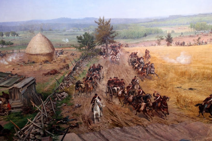
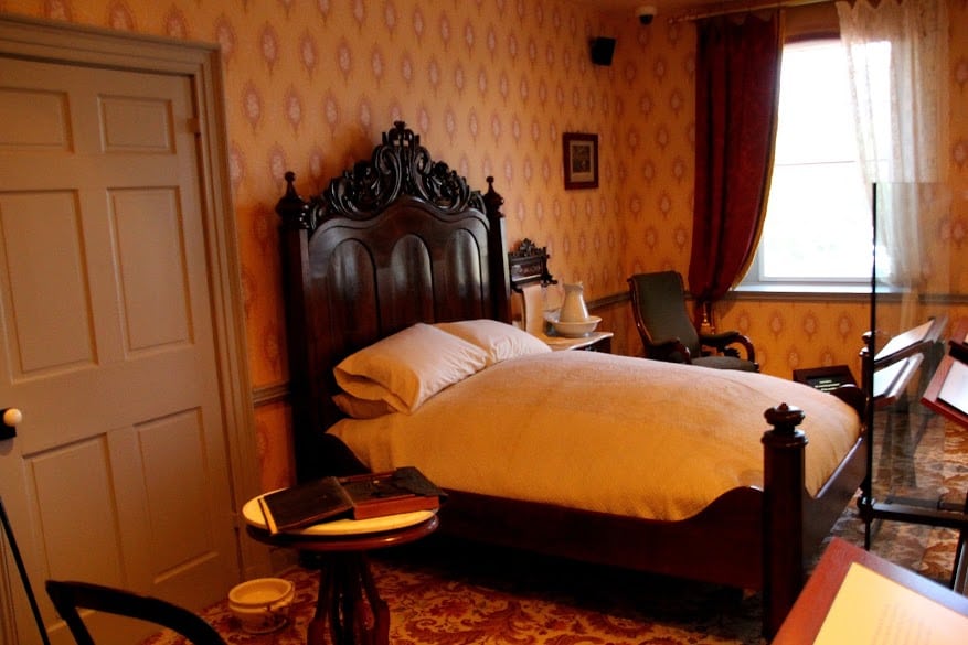
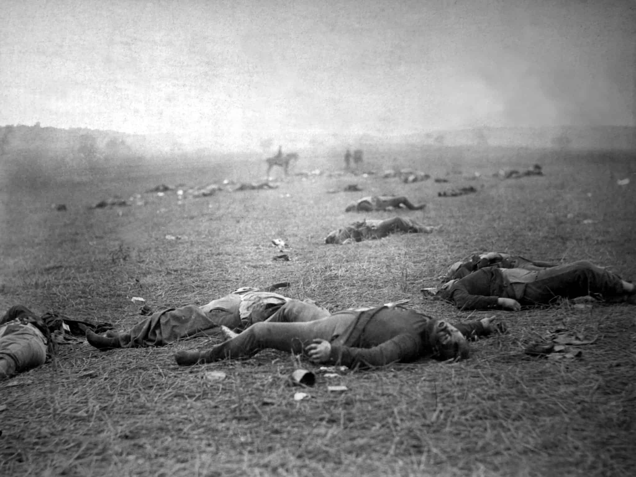
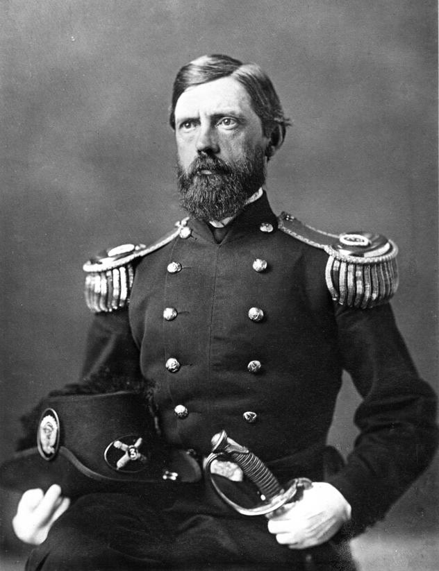
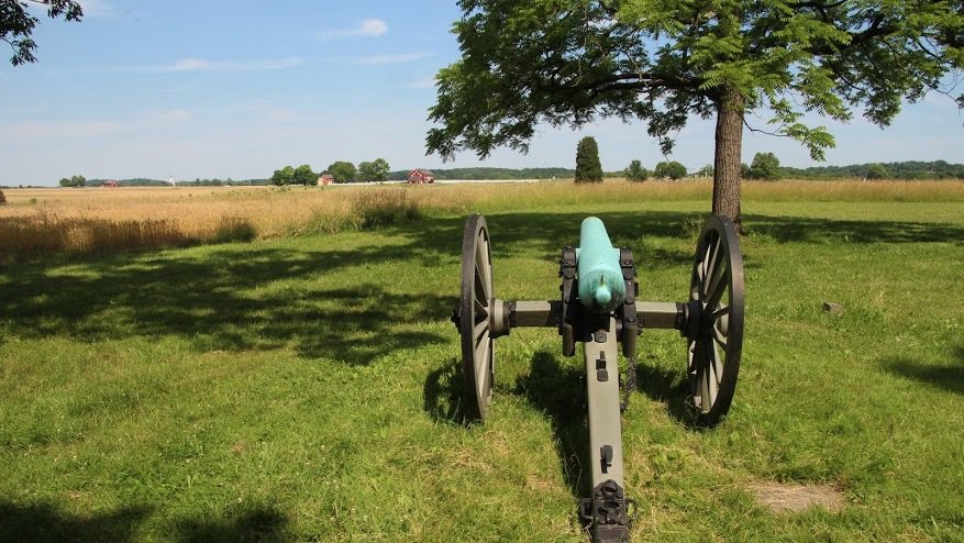
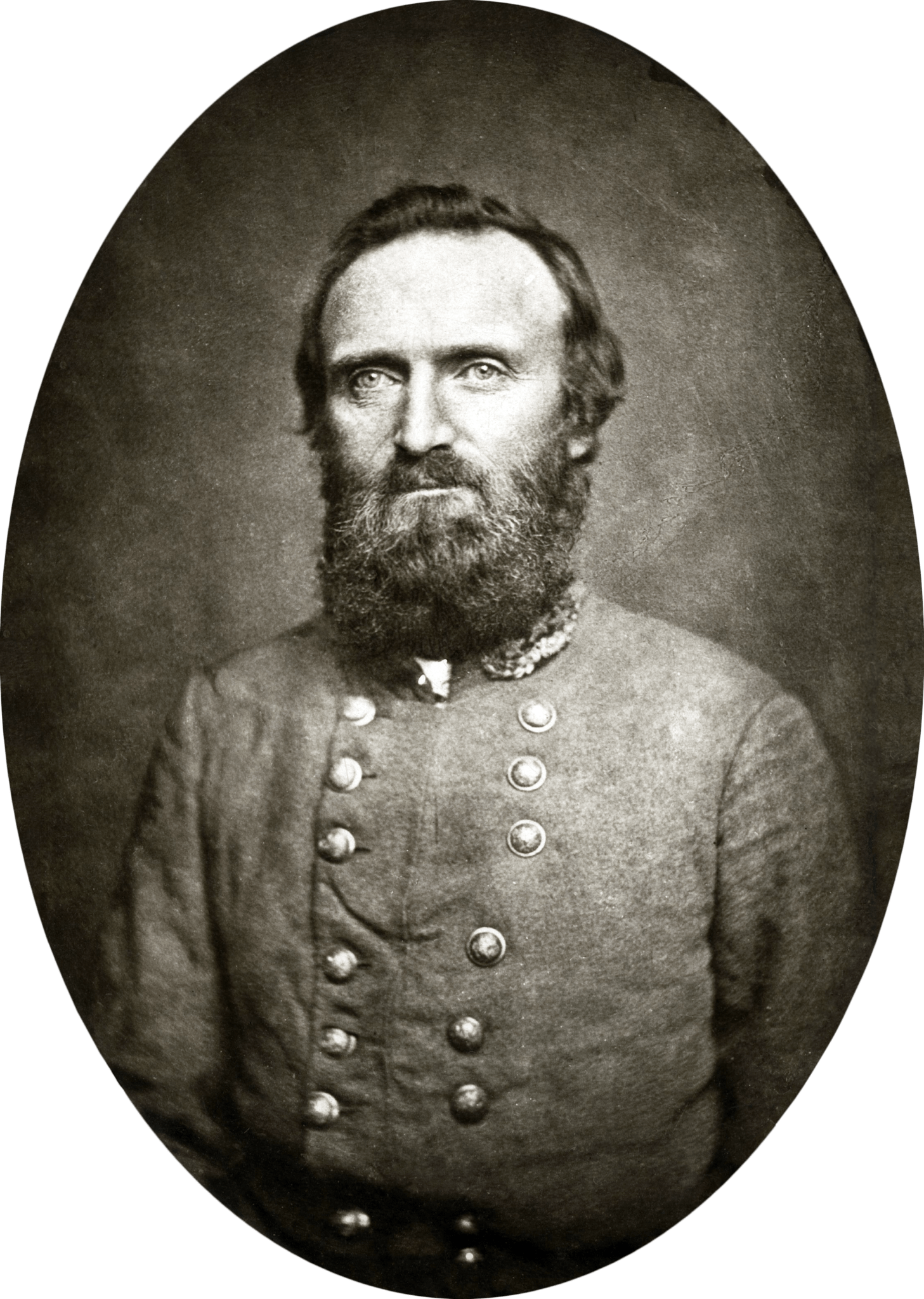
Is any war or battle glorious or is this myth propagated so that young men and women are willing to fight and die?  I grew up on Marine Corp bases during the Vietnam conflict, the first war fought in full public view via our RCA and Philco consoles.  When CBS anchor Walter Cronkite, who was called the most trusted man in America, traveled to Vietnam in 1968 and announced it was time for America to pull out, President Johnson reportedly told an aide, “If I’ve lost Cronkite, I’ve lost middle America.”  I certainly felt lost.  Maybe a battle that happened 100 years earlier would illuminate things.
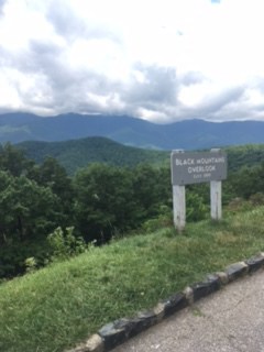
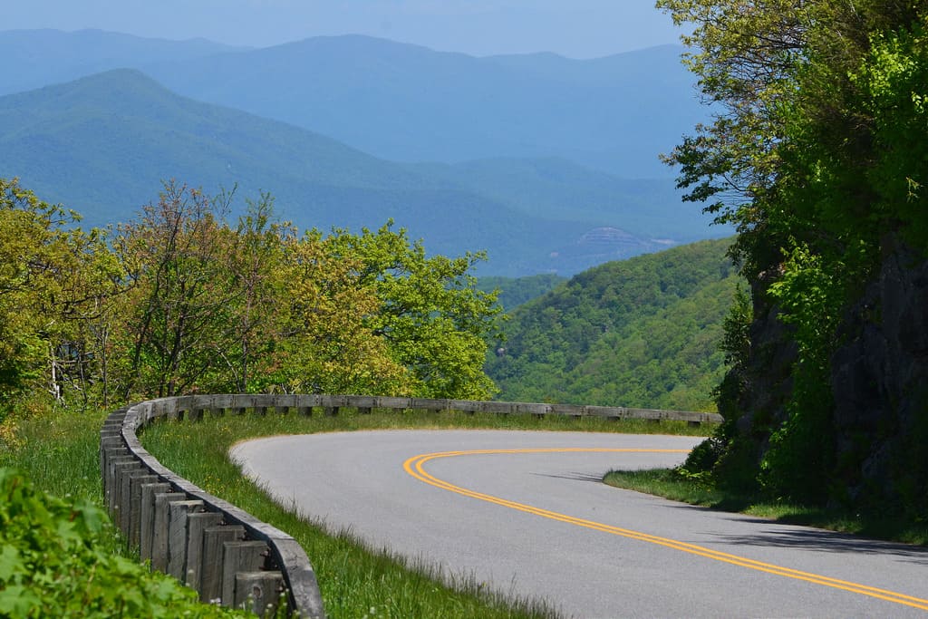
Visiting the battlefield at Gettysburg, Pennsylvania was on my bucket list and became a key motivator to make it to it this farthest point on my 2016 road ramble.  Years ago, I was casting about for a book as my selection for that season’s book club list.  NPR’s Nancy Pearl was talking with people around the country to find out what they were reading on summer vacation.  A lifeguard from Rhode Island called in to recommend The Killer Angelsir?t=funkytexastra-20&l=am2&o=1&a=0345348109 The Takeaway from Gettysburg, a work of historical fiction that looked at the Battle of Gettysburg from the perspective of commanders and troops on both sides. I had never heard of Michael Shaara’s Civil War novel ir?t=funkytexastra-20&l=am2&o=1&a=0345348109 The Takeaway from Gettysburg even through it had won the Pulitzer Prize in 1975.  Turns out the book was mostly ignored until 20 years after publication and five years after Shaara’s death.  In 1974, the country was so fatigued after the protracted mess of Vietnam that novels about war and warriors were out of favor.  It took Ken Burns and his PBS series, The Civil War, which captured 40 million viewers, to resurrect the novel.  Burns mentioned that The Killer Angelsir?t=funkytexastra-20&l=am2&o=1&a=0345348109 The Takeaway from Gettysburg had helped him develop an interest in the Civil War.  Ted Turner saw Burn’s PBS documentary and funded the 1993 movie version of the book.  Turner renamed the movie Gettysburg.  Suddenly, The Killer Angelsir?t=funkytexastra-20&l=am2&o=1&a=0345348109 The Takeaway from Gettysburg was at the top of the New York Times Best-seller list.


The battle, with its bad and good decisions, missteps and faulty intelligence, acts of selfless courage and horrific death toll of both men and the horses who carried them or dragged their cannon – seems anything but glorious.  Career military men were fighting men who had been their comrades a few short years before.  Michael Shaara ruminated on how their dilemmas and divided loyalties added to the confusion of combat.  Two thirds of southerners owned no slaves.  Many northerners had never seen a black man.  The grand purpose of this war was abstract to many of those waiting up on Cemetery Ridge and down low in the farm fields that surrounded it.  Two huge armies filled with frightened, anxious men were waiting for orders to defend or attack.  General Schwarzkopf described The Killer Angelsir?t=funkytexastra-20&l=am2&o=1&a=0345348109 The Takeaway from Gettysburg as “the best and most realistic historical novel about war that I have ever read.”  It has been required reading at different times in military academies and in officer training schools throughout the different service branches.  My father probably read it when he was going through officer training after rising to the top of the enlisted ranks in the Marine Corp.

jackie-and-me-alexandria-300x164 The Takeaway from GettysburgMy friend Jackie and I left Maryland on a Monday morning in early June, headed up I-270 to US 15 North.  Once off I-270, it was a quiet hour-long drive that gave us time to catch up after so many years apart.  There are some people in your life you will always be close to,  no matter how far and how long your separation.  Jackie and her husband, Dewey and my husband, Hank and I married around the same time.  We bought our first houses almost next door to each other, shared the victories and vicissitudes of our first career steps, and became parents around the same time.  These life events bound us as well as a love of exploring new places and meeting new people.  Jackie had already been to Gettysburg twice.  I could not have a better road dog for my first time.

gettysburg-farm-300x169 The Takeaway from GettysburgEven though over a million tourists visit Gettysburg every year, the area is remarkably tranquil and serene.  Once we turned west onto PA 116, there were sporadic commercial developments but it had not become Disneyesque as I had feared.  Entering town, there was a McDonalds and a few other fast food chains but we passed them quickly and entered Gettysburg proper.  Many of the brick homes and buildings had brass plates by their doors signifying the structure existed in July of 1863.  The old visitor’s center has been rebuilt and relocated farther south, away from its first location close to the national cemetery.  According to Jackie, this center is much bigger to accommodate the ever- growing crowds which came after the twin boosts of Ken Burn’s documentary and the rediscovery of The Killer Angelsir?t=funkytexastra-20&l=am2&o=1&a=0345348109 The Takeaway from Gettysburg.  We got in line for tickets to the 20-minute film, “A New Birth of Freedom” which sets the stage for the battle.  It was 10 am and the first film showing we could attend was at 11am.  We also wanted to get a licensed battlefield guide for a personal tour of the battlegrounds.  The earliest we could connect with one was at 2:30p.  It was going to be a disjointed day but Jackie assured me it would work out well.

cyclorama-300x200 The Takeaway from Gettysburg
Pickett’s Charge Cyclorama

The film helped us appreciate the accidental nature of this monumental engagement and the horror when the unsuspecting Gettysburg community found itself suddenly in the middle.  It was like going to bed after watching news reports of the Iraq war and waking up in Fallujah.  While still mulling over why the battle happened at this place, at the film’s end, we were herded from the theater up two flights of stairs into a dark, circular tower.  When our eyes adjusted, we were surrounded by the 1884 Pickett’s Charge cyclorama, a 360-degree oil on canvas painting 377 feet long by 42 feet high that depicts the noise, smoke, and carnage of the final Confederate assault.  Our crowded group shared the vantage point of the Union defenders on Cemetery Ridge while explosions and flashes simulated Confederates coming closer and the forces converging, thrusting us into the front lines without the modern contrivance of CGI.  We skipped the Gettysburg Museum of the Civil War, which contains thousands of Civil War relics, which along with the cyclorama inspired Shaara.

According to Phil Leigh in the New York Times Opinionator ,” One-hundred-and-one summers after the Battle of Gettysburg, a family of four stopped their Nash Rambler at the site during a 1,000-mile drive from the New York World’s Fair to Tallahassee, Fla. The father was a New Jersey-born former boxer, paratrooper and policeman who became a creative writing instructor at Florida State after enrolling to study opera. Before arriving at the park he had published dozens of science-fiction short stories, but nothing about history. But he had researched several Gettysburg participants for the trip… because Michael Shaara was in the early stages of creating his masterpiece novel, The Killer Angelsir?t=funkytexastra-20&l=am2&o=1&a=0345348109 The Takeaway from Gettysburg.”

The_inspection_and_sale_of_a_slave-300x226 The Takeaway from Gettysburg
The inspection and sale of a slave. By Brantz Mayer (Own work by the original uploader) PD-US, via Wikimedia Commons

From another short film at the visitor’s center, I learned how contentious slavery was even before the creation of the Declaration of Independence.  Many of the signers opposed slavery, which they felt had been super-imposed on the colonies by the British.  Benjamin Franklin wrote that the Virginia Assembly had petitioned the King of England for permission to enact a law banning importation of more slaves into that colony.  Renee Nal in “America’s Founding Fathers:  How did They Really Feel About Slavery” , found that John Jay, the president of the Continental Congress spotlighted the hypocrisy when he wrote, “That men should pray and fight for their own freedom and yet keep others in slavery is certainly acting a very inconsistent, as well as unjust and perhaps impious, part.”   George Washington, John Adams, John Quincy Adams, even slave-holding Thomas Jefferson all supported an end to one man owning another human.  This controversy had been festering in America since inception.  It was like a cat bite that heals over quickly only to continually erupt in a bigger and bigger sore until the infection was obliterated.  The Civil War would begin the massive cauterizing cure. 

lincoln-bedroom-300x200 The Takeaway from Gettysburg
Lincoln sleep here in David Wills’ house on the night before the Gettysburg Address. Image by Jackie Peace

It was 12:30 and we would not get our battlefield guide for two hours.  Jackie and I decided to drive around the old part of Gettysburg.  At the town center, the only parking space open was in front of the Wills house.  The house is a National Park Service museum in downtown Gettysburg and tells the story of David Wills, Lincoln, and the Gettysburg Address which sounded like a boring, Lincoln-slept-here exhibit but it was air-conditioned and we had time to kill.  It was anything but boring and in retrospect, completed the story of battle by telling its aftermath.

Ten roads lead into Gettysburg which had  a population of about 2400 in 1860.  Over four-hundred buildings housed manufacturing, shoemakers and tanneries plus retail establishments, surrounded by farmlands.  Gettysburg’s roads and what lay along them drew 157,000 soldiers here to meet from July 1-3, 1863.  One third of these soldiers would become casualties.  Describing the town after the battle,  HistoryNet.com recounts, “At field hospitals around Gettysburg, amputated limbs lay in heaps and were buried together. Bodies were collected at various points on the field and interred near where they fell…Homes, churches, any suitable building was pressed into service as a hospital…Apart from the human carnage, some 5,000 horses and mules died in the battle. They, too, had to be collected and burned in great pyres, leaving a stench that hung over the area for weeks.”

Battle_of_Gettysburg-aftermath-300x225 The Takeaway from Gettysburg
“The Harvest of Death”: Union dead on the battlefield at Gettysburg.  Image from  July 5–6, 1863 by Timothy O’Sullivan

David Wills was an attorney living in  Gettysburg. After the combatants left,  Wills helped tend the wounded and lobbied for compensation for farmers and field owners who suffered property loses and asked the Governor for help to bury the dead.  A permanent national cemetery for the Union dead at Gettysburg was suggested during a meeting at the Wills House.  Wills invited President Abraham Lincoln to speak at the dedication of the cemetery and Lincoln stayed at the Wills home in November 1863.  In his Gettysburg address, Lincoln took exception with the idea of a dedication.  “In a larger sense, we cannot dedicate — we cannot consecrate — we cannot hallow — this ground,” the president said.  “The brave men, living and dead, who struggled here, have consecrated it, far above our poor power to add or detract.”

lincoln-and-common-man-300x200 The Takeaway from Gettysburg
The Return Visit. Image by Jackie Peace

Just behind the Wills House and in front of a old store front now housing a thrift shop, we ran into a scarily realistic and life-sized Lincoln appearing to give directions to a tourist in a sweater and pink button-down shirt.  On a 90 degree plus day, the layered outerwear of the tourist was as out of place as Lincoln amid tourists in athletic shoes and backpacks.  The painted bronze is by J. Seward Johnson, Jr. and called “The Return Visit”.  The Lincoln Fellowship of Pennsylvania placed it here in 1991.  According to the fellowship,” it represents ‘the common man’ with Abraham Lincoln, showing that the Gettysburg Address is as relevant today as it was in 1863.”  Reportedly, this bronze is the most true to life depiction of Lincoln and we spent some time examining his face from close up.  On-line, many people likened the common man figure to Perry Como, who didn’t always seem that life like from my memories of his Christmas TV shows.


Eateries lined all four streets of Gettysburg Square, but Jackie is a meal packer.  Years ago, she showed me around Washington D.C. and we ate on a blanket under the Carillon at Arlington National Cemetery while the Marine Corp Band played nearby at the Iwo Jima monument.  For this tour, she had made paninis and brought the peaches we’d transported from the Blue Ridge Parkway.  Driving back out to the surrounding battlefields, we found a shaded picnic table off West Confederate Avenue near Warfield Ridge.  It was long past noon and we were alone among shading trees.

Back in my Subaru, we had a little over 30 minutes before we returned to the visitor’s center to pick up our guide.  Many of the viewing spots were crowded with cars and buses spilling out passengers for the audio driving tour. The exception was Big Round Top Mountain.  Privately owned in 1863, this mountain was too steep, wooded and rocky to have an artillery placement.  Confederate snipers had possession until late the evening of July 2.

stone-wall-300x169 The Takeaway from Gettysburg
Remains of stone wall on Big Round Top Mountain. Image by Jackie Peace

We took our pick of a dozen spots at the empty parking area and found where fighting had followed a stone wall up the slope.  Avoiding tangled roots and poison ivy, I climbed to near the summit and  found a simple rectangular marker on a rocky outcropping.  The engraving on the downhill side read ,” The 20th Maine Reg. 3d Brig. 1st. Div. 5th Corps Colonel Joshua L. Chamberlain captured and held this position on the evening of July 2d, 1863, pursuing the enemy from its front on the line marked by its monument below. The Regt. lost in the battle 130 killed and wounded out of 358 engaged.  This monument marks the extreme left of the Union line during the battle of the 3d day”

20th-maine The Takeaway from Gettysburg
20th Maine marker on Big Round Top Mountain

Joshua Chamberlain was wounded six times, earned the Medal of Honor, and went on after the war to serve as Governor of Maine and President of Bowdoin College. He captured the imagination of Michael Shaara and became one of the best known participants in the Battle of Gettysburg due to The Killer Angels and the movie it inspired.  Big Round Top also had monuments to the 5th, 9th, 10th, and 12th Pennsylvania Reserves along with the 118th and 119th Pennsylvania Volunteers and the 9th Massachusetts Volunteers.  In all, there are over 1300 monuments in Gettysburg to regiments, batteries, and individuals.  Jackie told me new monuments are no longer allowed to be erected at the battlefield.  The markers are so plentiful and diverse along some roads that it can seem like the Roman emperor Hadrian’s villa.  The memorials on Big Round Top were widely spaced, weathered, and simple.  They blended into the boulders and trees and were somewhat hidden from each other as the different patrols would have been during the night of July 2.

We drove back to the visitor’s center to pick up our Licensed Battlefield Guide.  We had signed up for the final tour slots of the day, which would last until 4:30 or 5P.  Jackie and I sat on benches across the lobby from the will call window.  One by one, men and women with clipboards and matching hats started coming out of a door to the far left of the admissions area.  They would first go the will call window and then cross the lobby towards us, calling out names to find their charges.  An incongruous thought struck me.  The guides paraded out in single file like beauty pageant contestants who affixed an on-stage smile as they came forward to met each group.  Our guide, Andy would have been Miss Vermont.  He was middle-aged, owned and worked at an electronics store in Stowe during the ski season.  He was single and had a BA in History, which he was happy to use every summer as a Gettysburg Guide.  He had been coming south for the summer for at least a decade, living in a one- room efficiency and working with a couple of groups each day.  As he asked for my keys, he said one perk of being a guide was getting to test drive lots of different makes and models of cars.  He adjusted the Subaru’s driver seat back to its farthest position, and we set to see where North first met South.

We drove through the town of Gettysburg and out to the northwest where on June 30, 1863, scouts from John Buford’s Union cavalry first entered Gettysburg and realized Confederates were close.  We idled in a parking lot for a restroom used by the tour buses.  From there, we had a clear view of the open and gently sloping land where the first shots would be fired.  Andy painted the picture as Buford took cover and hurriedly sent a message to Major General John Reynolds in Maryland to bring his infantry.  The two massive armies have been seeking each other for weeks and Buford’s cavalry stood between them.

As we drove to the site of the first day’s battle, Andy helped us decipher some of the hundreds of markets.  He explained that Union bridgade HQ’s had square bases, Confederates had round.  Division and corps headquarters are rectangular with rectangular bronze plaques and so forth.  “Will there be a test?”  I wondered.

GenJFRenyolds-230x300 The Takeaway from Gettysburg
General John Reynolds Library of Congress PD-US

Parking by a line of trees near McPherson Ridge, Andy pointed out where Reynolds and his troops arrived around 10:30a on July 1 to reinforce Buford, who has been fighting since 7:30 that morning.  Reynolds, according to Andy one of the most romantic figures of the conflict, was killed almost immediately while placing his troops.  After the battle, Reynolds body was collected and found to be missing his West Point Ring.  For a man who was married to the military, it was unthinkable that he had lost it.  Andy told us that the mystery was solved when a woman named Katherine May Hewitt revealed that she had it.  She and Reynolds were engaged but kept is a secret because she was Catholic and he was Protestant.  Together they agreed that if he died in the war, she would enter a convent.  After his burial, Katherine traveled to Emmitsburg, Maryland, and joined the Order of the Daughters of Charity.  You could tell how touched Andy and many men would be by the undying love on both sides.  We pragmatic women, perhaps more hardwired for the preservation of the species, might decide that Katherine and General John wasted the time they would have had together.

Because we had Andy driving just Jackie and me, we could stop at will and he could point out nuances and mistakes that eventually changed the battle outcome.  Throughout the day on July 1, divisions from both sides of the conflict were arriving.  At 2:15p, Robert E. Lee got there.  We drove to the Eternal Flame monument where at 3p (around the same time of day that we are there), the Confederates attack with their biggest division.  At 4p, Jubal Early (my favorite southern name) arrives with his division, attacks, and crushes the Union’s “Dutch Corp” which causes the Union line to start collapsing.  The Union retreats to Cemetery Hill and at 5pm, it looks like Lee has won another stunning victory.  At midnight, Union General Meade arrives and decides to make a stand on Cemetery Hill.

By 4pm on July 2, the entire Army of Northern Virginia was at Gettysburg.  Skirmishes blew up from late afternoon until dusk and overnight there was frequent firing by pickets and the Big Round Top kerfuffle.

IMG_0086-300x200 The Takeaway from Gettysburg
Image by Jackie Peace

Andy drove us past Confederate-held positions like the Rose farm, the Peach Orchard, the Wheatfield, Trostle farm, and Devil’s Den.  Andy was not a fan of Union Major General Daniel E. Sickles, who sounded like a posturing politico as inept as Joshua Chamberlain was competent.  However, Sickles was not without inventiveness. At Devil’s Den, he had a leg shot off and preserved it in formaldehyde.

On July 3 at 4:30a, the Union commenced the battle for Culp’s hill.  Attacks and counter attacks went for seven hours.  At 1pm, Jeb Stuart’s Confederate cavalry went after General George Custer on the Union’s rear on Cemetery Ridge.

Around that same time, two cannon shots signal that it was time to concentrate the Confederate attack on the copse of trees on Cemetery Ridge.  Andy had shown us the vantage point where Lee had contemplated this final attack.  While it looked like a straight shot across the fields, from the Union position looking back, it was more apparent how undulating the terrain is and how much ground the Confederates would have to cover.  Between 2 and 3p, General Longstreet gave the order for Pickett’s charge and at 4p, about 200 Confederate troops madeit to the stone wall but are repelled.  The tide of the battle and ultimately the war had turned.

cannon-300x169 The Takeaway from Gettysburg
Image by Jackie Peace

With Andy, we stared inside cannon, walked in the steps of foot soldiers on both sides and climbed up and onto the defensive positions on Little Round Top and Cemetery Ridge that we had experienced with the 1884 Cyclorama five hours earlier.  As quickly as the battle had materialized, the forces moved on, leaving behind destroyed fields and homes, wounded, dying and dead men and livestock that would take Gettysburg and David Wills years to clean up.  Lincoln would join the dead less than two years after his Gettysburg address.

Is any war or battle glorious?  For me, the answer is no.  However, sometimes it is necessary.

Road Ramble 2016 – The Blue Ridge Parkway and Skyline Drive area

Road Ramble 2016 – Asheville, North Carolina

Road Ramble 2016 – Mississippi and Alabama at Lookout Mountain

Road Ramble 2016 – New Orleans and driving through Louisiana

signature The Takeaway from Gettysburg

Filed Under: Gettysburg, Pennsylvania, Places · Tagged: Civil War, General John Reynolds, Joshua Chamberlain, Licenses Battlefield Guides, Michael Shaara, The Killer Angels

Jul 09 2016

Road Ramble 2016 – The Blue Ridge Parkway and Skyline Drive

blue-ridge-parkway-sign-300x225 Road Ramble 2016 - The Blue Ridge Parkway and Skyline Drive
Image by Ken Lund via Flickr. CC by 2.0

After the three-day layover in Asheville, Mary Ann came along for the seven to nine hour drive to Maryland to see some more invasive Texans who now called Maryland home.  Because our friends were teachers and had graduation ceremonies on Friday, we waited until noon on Friday to leave Asheville.  That would  break up the trip and get us to Gaithersburg on Saturday afternoon.  We also got the opportunity to  scare some poor guy  in a Motel 6  outside Roanoke when M.A. and I misread our key card and tried to break into his hotel room. Fun and games on the road.

We wanted to travel at least part of the way along the Blue Ridge Parkway.  Combined with the Skyline Drive in Virginia, these ridge roads would take us over 490 miles in the right direction but still left us 80 miles shy of our final destination. Figuring on top speeds of 45 mph and frequent 25 mph sections, using the BRP for the entire trip could take all weekend.  We’d jump on and off, using I-81 to make up some time.   Our plan was to pick up the Blue Ridge Parkway north of Asheville to avoid the Biltmore congestion.  That decision looked good on paper.


We left Asheville on I-40 and picked up US-70 at Old Fort.  At Pleasant Gardens, we turned onto Highway 80 and started to spiral up for the next several miles.  It was like driving inside a forested silo as far as the line of sight went.  We had exchanged the congestion in Asheville for a path of no return – no  turn-arounds or shoulders and very few cars coming the other direction.  Mary Ann swallowed a Dramamine.  My fingers were starting to cramp from tightly gripping the steering wheel.   There was a reason AAA had not taken us this way on our Triptik.

Marie-François_Firmin-Girard_-_Ulysses_and_the_Sirens_1868-1-300x209 Road Ramble 2016 - The Blue Ridge Parkway and Skyline Drive
Painting by Marie Francois Firmin Girard

Coming out of another seemingly endless blind curve, we came to an intersection. A pullover beckoned like a Ulysses siren from across the road.  Mary Ann and I swerved in, getting withering  looks from two outdoor types in an SUV enjoying their moment with nature.  Mary Ann jumped out of the car and gulped in fresh air.  I shook and wiggled my fingers and did some moving in place exercises to get blood flowing after a permanent clinch of all voluntary muscles for the last thirty minutes.    Our “Texas” license plate confirmed for our neighboring SUV-ers that the flat-landers had arrived.  Finally, we saw the sign.  We had made it onto The Blue Ridge Parkway.

18106700281_0a6bc1885f_n-300x225 Road Ramble 2016 - The Blue Ridge Parkway and Skyline Drive
Appalachian National Scenic Trail Survey Marker – BlueRidgeParkwayNPS

Originally called the Appalachian National Scenic Highway, the BRP was started in 1935 under Franklin D. Roosevelt using mostly private contractors. Various New Deal public works agencies did some of the work, including the Works Progress Administration (WPA) for some roadway construction, the Emergency Relief Administration for landscaping and developing recreation areas and the Civilian Conservation Corps (CCC) for  roadside cleanup and plantings, grading slopes, and doing some improvement on adjacent fields and forest lands. During World War II, conscientious objectors in the Civilian Public Service  took over from CCC and the young men who were fighting in Europe and the Pacific.

According an article called “Designing the Parkway” in the Blue Ridge Parkway Directory and Travel Planner, “Overall, the Parkway was to reveal the charm and interest of the native American countryside as the designers perceived that to be.  Log cabins, and barns, rail fences and pioneer ways were looked upon much more favorably than some of the more modern presentations of America that had already found their way into the mountains in the 1930s and 40’s.” The Parkway’s construction created needed jobs but there were losers in the project too – displaced residents and landowners and farmers who faced new regulations, including how crops could be transported.  Land use and development was limited to agriculture and no commercial traffic could use the Parkway so equipment, materials and produce had to travel on side roads.

Once again, the Cherokee were affected. This time, it was the eastern band of Cherokee.  The Parkway was to be built through their lands.  Perhaps learning from past dealings with the US government, the Cherokee refused to give up right of way until 1940 when they negotiated payment for their land.  They also demanded and got the state to build a regular highway through the Soco Valley.  It is now part of US 19.

Most of the Parkway project was completed in 1966 except for a portion of the  area we were traveling.  This stretch included the Linn Cove Viaduct and Grandfather Mountain and  didn’t open until 1987, fifty-two years after the start of construction.

black-mountain-overlook2-jpg Road Ramble 2016 - The Blue Ridge Parkway and Skyline Drive
Black Mountain Overlook

We’d entered the Blue Ridge Parkway at Buck Creek Gap at Mile 344.  Every mile or three was an overlook – Black Mountain, Three Knobs, Deer Lick Gap.  Those were three to stop at before we’d even gotten as far as Little Switzerland off to the east at Mile 334. Little Switzerland was built in 1910, a very old world mountain lodge with cottages, restaurants, tennis and golf.  It presented a jarring contrast between the displaced mountain folk and the people who could vacation at Little Switzerland in the early part of the century.  But we were here for nature not comfort so we drove past the resort and  headed for Linville Falls.

The Linville River starts on the steep slopes of Grandfather Mountain and descends almost 2000 feet through a rugged gorge, prompting the Cherokee to call the river “Eeseeoh” or “river of cliffs.”  To get industrialist John D. Rockefeller to pick up the tab for the Linville Falls property, he was treated to an al fresco lunch to take in the grandeur.  The picnic was spread out in view of the falls and coincidentally close enough to hear the noise from sawmills diligently deforesting the slopes  like a bevy of beavers.  The picnic plan worked perfectly.  As we snacked and visited with picnickers along the shaded river at the Linville Falls visitor’s center, we raised a Yeti rambler to ole’ John D and his gracious gift.

driving-view-of-brp-300x200 Road Ramble 2016 - The Blue Ridge Parkway and Skyline Drive
Image by BlueRidgeParkwayNPS

Our  dilemma how frequently to stop at a visitor center or overlook on the Blue Ridge Parkway.  Each stop gave you a chance to pause and savor the scenery but a drive provided an unfolding view of both the majestic surroundings and the virtuoso design the planners and builders of the Parkway had achieved.  The Parkway was meant to “lie gentle on the land” and this intention was well met.   Bridges merged into the roadways with continuous shoulders of grass.  There was no side stripping on the road to create a hard line between the pavement and natural setting. Many times, the long and distant views opened up to delight just as you come out of a curve.  Because there are few straight lines in nature, on the Parkway, one curve flowed into the next like a river.  Fences are made of stone, wood or different combinations to blend into the fields and forests.  “Look!” was an overused word that afternoon in our car.  How could you take it all in?  I now see why the Parkway is a destination to visit often, slowly moving your camping base a few miles down the road every year to explore it piece by lovely piece.

Linn_Cove_Viaduct-300x225 Road Ramble 2016 - The Blue Ridge Parkway and Skyline Drive
Linn Cove Viaduct by uploader Bill Pearmain at English Wikipedia
At Mile 304, we started across the Linn Cove Viaduct, whose completion had been delayed twenty years after the rest of the Parkway opened to the public.  Architects and engineers were struggling with how to preserve the fragile environment on the slopes of Grandfather Mountain.  According to the National Park Service, the dilemma was “how to build a road at an elevation of 4,100 feet without damaging one of the world’s oldest mountains. National Park Service landscape architects and Federal Highway Administration engineers agreed the road should be elevated, or bridged, where possible to eliminate massive cuts and fills.”

“The result: the Linn Cove Viaduct at milepost 304.6, the most complicated concrete bridge ever built, snaking around boulder-strewn Linn Cove in a sweeping “S” curve”.  Construction began in 1979 and the challenges faced and overcome where massive.  For a complete history of building this “missing link” on the Parkway, read more at The National Park Service   Once again, the Parkway builders had created a compelling compromise to preserve a scenic treasure.

Cones_Mansion_near_Blowing_Rock_N.C._1911-300x193 Road Ramble 2016 - The Blue Ridge Parkway and Skyline Drive
Manor postcard – By The Brown Book Co., Asheville, North Carolina – Beinecke Rare Book & Manuscript Library [1], Public Domain
We had decided to jump off the Parkway after Blowing Rock and head through Boone to get to the interstate.  Due to our unnerving experience getting onto the Parkway, we needed to plan ahead and find a bathroom before committing to another unknown mountain exit road.     We saw a sign for Moses H. Cone Memorial Park and a visitor center so we turned off the Parkway and headed into the woods.  We were expecting a generic rustic park office manned by rangers with picnic tables under the trees.  Here we encountered one of those fortunate detours that can define your whole experience of the parkway.  Suddenly we were transported from Appalachia to what seemed like Austria and the Von Trapp estate in the “Sound of Music.”  Moses H. Cone’s Flat Top Manor rivaled George Vanderbilt’s Biltmore in Asheville but was built in this soothing ,isolated, alpine setting.

long-stop-linda-a-manor-house-unedited-300x225 Road Ramble 2016 - The Blue Ridge Parkway and Skyline Drive
Linda savoring view from Flat Top Manor
looking-at-lake-a-manor-225x300 Road Ramble 2016 - The Blue Ridge Parkway and Skyline Drive
Viewing the lake from Flat Top Manor porch

Moses, a textile entrepreneur, founded a company that became a major supplier of denim to the Levi Strauss and Company.  Using the profits from the excellent timing of his venture, Moses and Bertha Cone began acquiring land in the 1890s in the Blowing Rock area for his house.  Reporters of the time nicknamed him and his blue blood counterpart “Farmer Cone” and “Farmer Vanderbilt”. The total estate had a twenty-three  room mansion (now re- purposed as an  art center), twenty-five miles of carriage lanes, livestock, gardens, and an extensive orchard plus a number of other buildings including a bowling alley (since torn down).  The manor house is at an elevation of 4500 feet and looks down on an azure  lake.  Its location is ringed by mountains including the one that gave the house its name – Flat Top Mountain.  Because of its location and the working nature of Moses Cone’s estate, it was easier to believe that a family had happily lived and prospered here.  On my visit to the Biltmore, living day to day in that elaborately furnished mausoleum seemed inconceivable.

We left the BRP right after the Cone Manor and headed west to Boone, NC.  Boone was named after Daniel, the frontiersman and 60’s TV show character.  The town was settled by some of his nephews.  It is the home to Appalachian State University and it may have been graduation at the college because all the sidewalks downtown and around the school were swarming with what looked like proud parental units.  Railroad enthusiasts visit Boone to see the narrow gauge East Tennessee and Western North Carolina Railroad (nicknamed “Tweetsie”) which operated until the flood of 1940.  Mary Ann was interested in Boone because it apparently had a reputation akin to Roswell New Mexico for UFO’s and alien abductions.  The epicenter of all the interest is Brown Mountain and its mysterious lights.  According to BrownMountainabductions.com, people have been disappearing after seeing the lights for centuries, including twenty-seven people vacationing at a popular campground in October 2011. How did I not read about that?   The only thing getting abducted during our visit was a bag of peaches from a truck farmer in the parking lot of a hardware store.  We spirited them away to a Motel 6 in Roanoke for vivisecting.

Skyline_Drive_Virginia_map.svg-300x177 Road Ramble 2016 - The Blue Ridge Parkway and Skyline Drive
Skyline Drive map by Mr. Matte

On Saturday morning we headed up Interstate 81 until we tired of the fast pace. Leaving the freeway near New Market, we drove east on US 211 , winding  along and over the Massanutten Mountain and across the South Fork Shenandoah River.  The road enters the Blue Ridge Mountains in the Shenandoah National Park.   At Thornton Gap, we connected for a short time with Skyline Drive.  Skyline Drive takes up where the Blue Ridge Parkway runs out.  It travels 109 miles along the Shenandoah National Park and is another legacy of the Works Progress Administration (viva WPA!), begun in 1930 and finished in 1939.

We didn’t realize until we read the Shenandoah National Park website that we were “driving along one of the most significant tools the Confederacy utilized during the American Civil War.”  According to the website, “Throughout the four years of the Civil War (1861-1865), Confederate armies frequently used the Blue Ridge Mountains as a natural screen to conceal the movement of troops from Union forces. Because of the southwest-northeast orientation of the Shenandoah Valley west of the Blue Ridge, Confederate armies marching down the Valley naturally moved toward a position from whence they could threaten the northern cities of Washington and Baltimore, while Union armies marching up the Valley were forced to move farther away from the Confederate capitol of Richmond.”

Stonewall_Jackson_by_Routzahn_1862-213x300 Road Ramble 2016 - The Blue Ridge Parkway and Skyline Drive
General Thomas J. “Stonewall” Jackson by Nathaniel Routzahn (1822 – 1908), {{PD-US}}

The confederate commander who made best use of the Blue Ridge in this area was the fervently religious General Thomas J. “Stonewall” Jackson. Using cover from the ridge and his knowledge of its gaps and valleys, he and his 17,000 men won five significant victories in the Valley campaign against a combined force of 60,000. Like most of us, Stonewall was a flawed but heroic ball of wax.  He was an instructor at the Virginia Military Institute and parts of his curriculum are considered timeless military strategy and still taught, yet Jackson was an unpopular teacher.  Peculiar in his personal habits, humorless and a hypochondriac, Jackson was at the same time revered by both free black men and slaves around his hometown of Lexington, Virginia.   According to historian James Robertson, “Jackson neither apologized for nor spoke in favor of the practice of slavery. He probably opposed the institution. Yet in his mind the Creator had sanctioned slavery, and man had no moral right to challenge its existence. The good Christian slaveholder was one who treated his servants fairly and humanely at all times.”   In the spring of 1862 his daring success in the Valley campaign made Jackson the most celebrated warrior in the Confederacy.  In May 1863, he was shot by Confederate pickets at the Battle of Chancellorsville, had his arm amputated and died eight days later.  His last words were, “Let us cross over the river, and rest under the shade of the trees.”  We were taking Stonewall’s heartfelt advice.


signature Road Ramble 2016 - The Blue Ridge Parkway and Skyline Drive

Filed Under: Blue Ridge Parkway, North Carolina, Places, Virginia · Tagged: Boone North Carolina, Flat Top Manor, Lin Cove Viaduct, Linnville Falls, Moses H. Cone, Skyline Drive, Stonewall Jackson

Jun 27 2016

Living Like A Local in New Orleans – Road Trip 2016

NEW ORLEANS DAY 3 – JUNE 12, 2016:  More Frenchmen Street and The French Quarter on a Lazy Sunday

File-Jun-13-7-53-26-PM-300x225 Living Like A Local in New Orleans - Road Trip 2016
An old church coverted into a community opera house – Image by Rindy Jones Greer

We were winding down my send-off by friends with our New Orleans girls trip. Sunday was going to be a lazy day with no schedules. Rindy and I got rolling about noon and walked over to Maison on Frenchmen Street for a Jazz Brunch. On the way over, we stopped to listen to a man practicing his bagpipes in Washington Square. It have been threatening to pour all morning with dark skies, rolling thunder and a lightning show but surprisingly little rain. We took our chances, unwilling to give up any more of the day to the chance of showers. The bagpipe’s melancholy sounds complemented the coming storm and we stopped to listen for awhile. Then hunger drove us on.

 
File-Jun-13-7-52-56-PM-225x300 Living Like A Local in New Orleans - Road Trip 2016
Surrounded by his tools-Image by Rindy Jones Greer

Rindy found a a flyer for the jazz brunch at Maison in the info packet left for us at our house. She’d been looking forward to a cajun breakfast. We got to Maison in time for food but too late for the featured band. Instead we got the Slick Skillet Seranaders, a bango/kazoo player who sang lead with another guy on a bass fiddle and a third alternating between at mandolin and a steel guitar. They specialized in jazz and swing from the 1930’s. From Braveheart to Rudy Vallee in under three blocks.

Back to the quarter for a little shopping and sane people watching. The night before, we’d had to cross Bourbon Street to get our uber ride because a Weed Wagon handing out freebies had blocked traffic and the drunks were swàrming. Our uber guy told us that the Weed Wagon usually sets up after midnight because the police have too much on their hands at that time to chase them off. On a Sunday afternoon, Decatur and Jackson Square were colorful instead of nauseating.


Creole Tomato Festival was going on. We been told the NOLA has a different festival every weekend. The weekend before had been a Bugaloo event. As a joke, we asked a shopkeeper when to come for the pothole party since rough roads were everywhere. She said, “Don’t laugh. Last spring, a sinkhole opened up close to Harrah’s. In May, someone organized a Sink-Hole de Mayo Festival and people wore orange traffic cones strapped to their heads.”
 
That night, we went back to Frenchmen Street one more time to pick up a caricature one of our group had commissioned from an artist at the Frenchmen Street Night Market. Maison beckoned us in to hear a little more music. It is easy to see how quickly you would form a community here away from the tourist crush. We shut it down early. Rindy and Judy would catch noon-time planes back to Houston and Austin. I wanted to be on the road to Alabama and Lookout Mountain by 8:30 on Monday morning.


Saturday,  June 11, 2016 : New Orleans’s Magazine Street and the Quarter (at night)

 
IMG_6481-300x225 Living Like A Local in New Orleans - Road Trip 2016
Breakfast at the Gypsy House -Image by Rindy Jones Greer

We are getting to know our temporary neighborhood. The  Marigny is immediately downriver from the French Quarter but I still feel turned around and keep walking in the wrong direction. This area was once a creole plantation whose owner made “craps” (the dice game) popular. He was enormously wealthy and stylish. After the property was subdivided in 1806, it retained his mark by developing a distinctly European and cosmopolitan mix. We are staying close to Royal Street with a good mix of homes, restaurants, clubs and food stores. When we walked home around midnight last night, the area was quiet but active, much different from our experiences staying in the quarter or across Canal Street. This morning, Rindy walked a few blocks over to a 24/7 food store/deli and brought back all kinds of goodies for brunch – salami, cheeses, egg salad, pickles, fruit. People were walking dogs and babies, visiting with neighbors. Ubering home this afternoon, we passed an extended family holding a crawfish boil that extended on the sidewalk in front of approximately four homes. We haven’t seen a front or backyard on our walks so an inflatable water slide to keep the kids’ cool was in the parking area of a nearby warehouse.

 
Since we seeking to experience a new side of New Orleans, we decided to spend some time on Magazine Street instead of Jackson Square. Magazine Street has been finding its way over the last decade but it has arrived. Boutiques, specialty shops and antique emporiums crowded next to gas stations and foodstores with burglar bars on the doors. This isn’t Disneyland or Fredericksburg and there is graffiti visible every few blocks but the shopfronts and parks reflect how many years New Orleans has been around.
 
Since mid-morning, we’ve had heavy showers alternating with steam heat. Because of the schizophrenic weather, we took an Uber from the Marigny. LaToya, a brand new uber driver picked us up. We were her first fare even though she had been signed up with the service for months.
 
She dropped us in front of a hat store that specialized in matching your face shape and size with the right hat. We got a first-hand demonstration of the way the right hat makes the man or woman and finishes a look. It makes me wonder what happened that hats went away after the 60’s. Maybe hats did not accessorize well with granny dresses, love beads and Nehru jackets.
 
IMG_6486-300x225 Living Like A Local in New Orleans - Road Trip 2016
You Are Always Welcome at Juan’s-Image by Rindy Jones Greer

We shopped and stopped for nourishment at Juan’s Flying Burrito. As a rule, I am true to my favorite Houston Mexican restaurants so I don’t visit many when I’m traveling. Juan’s made me feel like I wasn’t cheating on Carmelitas because they put crawfish in everything, including the chili con queso which was technically mudbug with cheese. Portions were huge and we should have just stayed with the queso because we didn’t do justice to the bacon blue quesadillas. Cucumber margaritas was different enough from my favorite Los Tios Gold to seem like I was branching out but I also left most of mine. Some are true to their school, I’m true to my Los Tios Margarita.

After Juan’s we did more shopping and were much more open to spending money which made the shop owners happy. A few blocks further down Magazine Street we stopped for wine at the Tasting Room and watched as a wedding party forming in the park across the street. Knowing how stressful a wedding can be, I have a theory that the more elaborate the wedding, the lower the chances that the marriage will last. This one looked awfully complicated so I do wish them luck.
 
File-Jun-12-6-51-33-PM-300x225 Living Like A Local in New Orleans - Road Trip 2016
Watching the Wedding from the Tasting Room-Image by Rindy Jones Greer

We ubered back to the Marigny and our converted lodgings. Every uber driver has been a delight. This guy had just finished his pharmacy degree and wanted to know where we would suggest he move – Austin or Houston. All the hipsters we met on Magazine wanted to talk to Judy about Austin but this guy was immune to its lifestyle charms so Rindy and I pitched him on Houston’s medical opportunities. Score one for H-town. He was creole in every sense of the word, which we understood now that we had the education at the Laura plantation. He claimed European, Native American, and a little African in his bloodline. Our waiter at the wine room had just gotten here from Torino, Italy but looked like Bruce Springsteen until he opened his mouth. Our uber driver looked Italian until he spoke and had that distinctive NOLA accent that approximates the boss’s patois. Go figure.

 
Last night, we finally headed to the French Quarter for dinner at Tujaque’s, a restaurant since 1859. Rindy had eaten here some years ago so when we walked into a brightly lit, airy dining room, it didn’t match her memory. The waiter had been there since 1981 and said when the old owner died, the son took over and made everything white wood, taupe and mirrors. I wish we’d been there when it was dimly lit and dark paneled with drawings of the different stars and dignitaries who had eaten there through the years. The food was unchanged though. We shared a fried oyster wedge salad, gumbo, fried green tomato, shrimp remoulade and puppy drum.
 
On leaving Tujaque’s we stepped past the tourist who had fallen and couldn’t get up on the sidewalk. Both she and her companion where drunk but at least he was still standing and yelling, “Get up, Marie! Just get up!” The quarter at night was quickly loosing appeal.
 
We walked on to the Napoleon House on St. Louis where we got our dessert, brandy milk punches, but the crush was getting tiresome. The bartender told us that B Mac further down St. Louis was where the service people went to unwind. It was at B Mac’s we found a community.
 

File-Jun-12-6-52-27-PM-300x225 Living Like A Local in New Orleans - Road Trip 2016
Making Friends with Otis-Image by Rindy Jones Greer

We met people who lived and worked in the quarter including love sick T who kept casting eyes at his former lover and Otis the dog and his person. Otis was a overweight, brown, houndy-type, as mixed up as the creoles with chow, beagle and whatever else. His person said she got Otis after she divorced and husband got custody of their shared dogs because he had the yard. It was lonely living by herself and the people at her restaurant job told her about a dog that was hanging around. At first she opened her house but not her heart to Otis. He seemed to feel the same. “For the first two weeks, we didn’t like each other,” she said. “I’d be walking down the quarter with Otis, and people would call out, ‘do you two like each other yet?’ Finally we both decided we’d do for each other. There was still a little reserve going on between them but Otis was certainly loved by the off duty waiters and bartenders who made B Mac their second home. Otis would bark a greeting as different ones came in and he’d get a good scratch in return.


On Friday,June 10, 2016 – Odometer  385 Miles – New Orleans Màrigny District

 
IMG_6355-2-e1467043759520-225x300 Living Like A Local in New Orleans - Road Trip 2016
Oyster sign outside Liberty Kitchen in the Heights, Houston. Image by Rindy Jones Greer

We’re off. Picked Rindy up a little after 8a and got message from God that we were heading in the right direction – a sign at Liberty Kitchen annoucing “Oysters, Oysters, Oysters”. That is the plan as we head to NOLA for seafood, music and more. We drove east on 1-10, always a delight. A little outside of Baytown, we passed a blue pick-up truck traveling to some kind of weekend trade show. At first his over-loaded trailer seemed like a hazard to navigation but as we scooted past him, we realized is was another omen that good times were ahead. All the metal signs hanging off the side were welcome signs – welcome to the beach, welcome to the farm, welcome to the barn.

 
Judy had put together an eclectic playlist for us with Joe Ely, Morphine, Brooks and Dunn, NXCESS, Bruce the boss, The Gourds. As a music moron, I’m lucky to have friends who curate great playlist for me. It’s not what you know, but who you know.
 
IMG_6383-e1467043785365-225x300 Living Like A Local in New Orleans - Road Trip 2016
Crossing the Bayou-Image by Rindy Jones Greer

We exited I-10 just east of Lafayette and took LA-31 to St. Martinsville and New Iberia. St. Martinsville was considered the heart and birthplace of cajun culture. It was where the first Acadians from Nova Scotia landed after France was defeated in by the British in the Seven Years War. Later it was where New Orleans creoles escaped when epidemics threatened the Crescent City. St. Martinsville became known as a cultural mecca,  a “Petit Paris”.  It is the third oldest city in Louisiana and I’m so glad Rindy directed me off the road at this exit.

 
IMG_6421 Living Like A Local in New Orleans - Road Trip 2016
Slave/Sharecropper cabins at Laura Plantation – -Image by Rindy Jones Greer

From LA-31, we took Highway 90 east to avoid Baton Rouge and I-10 and check out the creole plantation, called the Laura. I’d read Laura Locoul Gore’s memoirs based on a friend’s love of the Laura Plantation. Having visited other plantations and seen “Gone with the Wind”, we expected the Laura to be a sumptuous home. This was a working plantation where the family lived and worked from April through December for the planting and harvest. Their bedrooms doubled as offices and up to ten people (with house slaves) slept in the small bed chambers. From December through March, they had a well- appointed home in New Orleans and celebrated Christmas, New Years and Mardi Gras in style. That is where the family flaunted their great wealth. Laura’s father, Emile Locoul, was a new breed of man who was questioning the humanity of keeping slaves which alarmed his mother, Elizabeth and caused her to plot with his sister Aimee. If he didn’t have an heir, according to creole law, Elizabeth and Aimee could sell the plantation and move to France, away from the never-ending work of a sugar mill farmer. Laura’s birth foiled their plans and felt their fury from the time she was young. She eventually sold the plantation and moved to St. Louis, marrying a Presbyterian, a cardinal sin for Catholic creoles. Ultimately, Laura lived almost 102 years. She was born when Lincoln was president and died when Kennedy held

On down the river road to New Orleans and our home for the weekend, a converted grocery store at the corner of Dauphine and Ferdinand. From our other visits in the French Quarter, we were in the middle of the tourist crush. Staying in the Marigny got us closer to New Orleans neighborhoods. We walked to Mimi’s for tapas and then to DBA on Frenchmen Street.
IMG_6465-e1467043822981-300x300 Living Like A Local in New Orleans - Road Trip 2016
On stage with the Zydeco Hellraisers-Image by Rindy Jones Greer

At DBA, a popular band was fronted by a lead singer who played the squeeze box. Dwayne Dopsie and the Zydeco Hellraisers was a radical change for Houston bands and just what we cam e to hear in New Orleans. Laissez les bon temps roulez and more wandering tomorrow.

 
 Road Ramble 2016 – Asheville, N.C. – Read More
Road Ramble 2016 – Mississippi and Alabama on Lookout Mountain – Read More
Road Ramble 2016 – Pre-Trip Planning – Read More

signature Living Like A Local in New Orleans - Road Trip 2016

Filed Under: Louisiana, New Orleans, Places · Tagged: DBA, Dwayne Dopsie, Frenchmen Street, Marigny

  • « Previous Page
  • 1
  • 2
  • 3
  • Next Page »
  • Email
  • Facebook
  • Instagram
  • Pinterest
  • Twitter

Search

Hey there!


please follow me


Just visiting someplace is boring – I dig around and roll in it. The people, the peculiarities and the hidden history that gives any destination its own unique story. Come excavate with me and let me know places I should go!

Traveling is my passion. What’s yours? Start a blog & share it!

How to start a blog and share your story
Whether you want to share family stories for your kids and grand-kids or become recognized expert in your field, blogging is your answer. Here's your step by step guide to get started.

Most Popular Posts

  • San Antonio south of Southtown – where to eat and drink

    San Antonio south of Southtown – where to eat and drink

    Discovering San Antonio south of Southtown helped me fall back in love with the Alamo City. Or more accurately, it took determining where to eat …
  • Plan to be flexible | #1 Lesson from Rally Recovery Drink | Texas startup success

    Plan to be flexible | #1 Lesson from Rally Recovery Drink | Texas startup success

    Texans know what it takes to succeed. Most will tell you it's critical to plan to be flexible. So flexible that you are open to …
  • Five Ways to Do Port Aransas Right | One Year After Hurricane Harvey

    Five Ways to Do Port Aransas Right | One Year After Hurricane Harvey

    Port Aransas has mostly recovered after worst hurricane season in U.S. history. Sadly, some beloved spaces are only sweet memories. Other hangouts seem comfortably the …
  • Lost at Buc-ee’s | How weird family stories start

    Lost at Buc-ee’s | How weird family stories start

    A man got lost at Buc-ee's in Katy, Texas. And stayed lost for over thirty minutes. Urban myth? No, I was there. How those weird …

How to start your blog

*If you have a passion, start at blog and share it!  Just click here for step by step guide.


Copyright © 2025 · Site design by Olive & Ivy Design